Heading to the Jersey Pines this weekend

  • Active since 1995, Hearth.com is THE place on the internet for free information and advice about wood stoves, pellet stoves and other energy saving equipment.

    We strive to provide opinions, articles, discussions and history related to Hearth Products and in a more general sense, energy issues.

    We promote the EFFICIENT, RESPONSIBLE, CLEAN and SAFE use of all fuels, whether renewable or fossil.
Status
Not open for further replies.

Badfish740

Minister of Fire
Oct 3, 2007
1,539
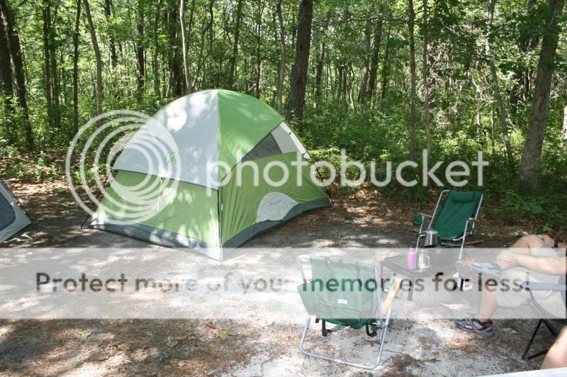
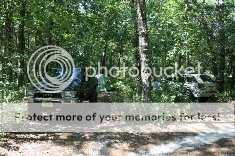
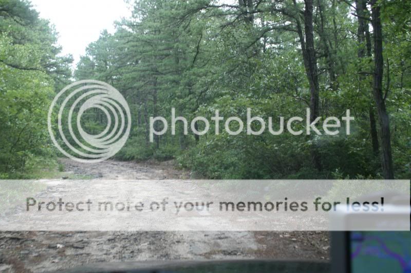
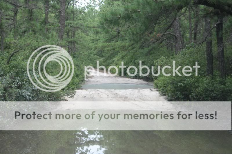
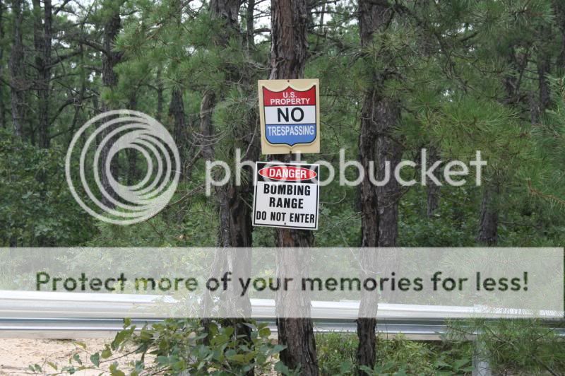
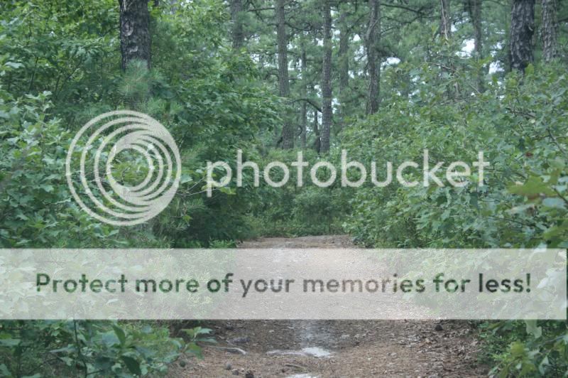
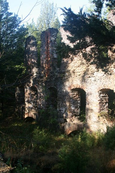
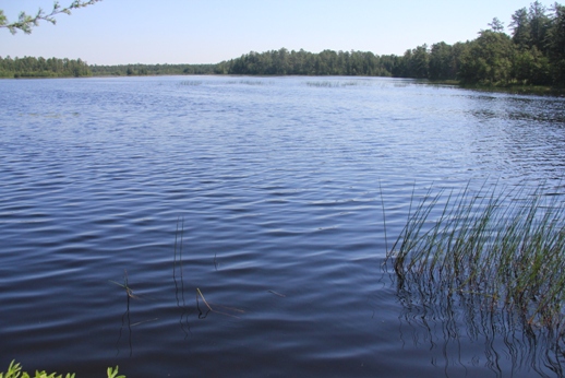
Funny how the week drags when you've got something good coming up on the weekend. Heading to the Pinelands for some camping, four wheeling, and a bit of amateur archaeology. I know we've got at least a few members here who hail from the Pinelands-any other explorers in the bunch? For those who don't know, the Pinelands (or Pine Barrens as they are often referred to) cover more than 1.1 million acres of Southeastern NJ. It's a very unique place where you can find solitude not often associated with NJ. I spent a lot of time there when I was younger because I lived a lot closer, but since I moved up to the Northwestern part of the state I haven't gone in a long time. We're camping at Bass River State Forest and will be exploring the many sand roads and firebreaks that crisscross the forest. The pines was once home to charcoal, glass, and iron making and holds more than a few ghost towns which we'll be looking for traces of, but due to the frequency of forest fires, only parts of foundations and cellar holes remain. Here's where we'll be camping:

http://goo.gl/maps/rSTt2

It's been too long since I've been in the woods-can't wait!
 
Watch out for the Jersey Devil. I grew up in Hackettstown and my Grandparents had a summer house in Beach Haven. Used to drive through the pine barrens quite often to get there/back and always enjoyed the change of scenery. Enjoy your trip.
 
Watch out for the Jersey Devil. I grew up in Hackettstown and my Grandparents had a summer house in Beach Haven. Used to drive through the pine barrens quite often to get there/back and always enjoyed the change of scenery. Enjoy your trip.


Did you pass the Route 539 Rock?

http://www.jamesrahn.com/personal/rock.htm

That was always a big hit for us as kids on the way to Long Beach Island from our house in Hamilton. We'll be deep in the heart of Jersey Devil country. Some pictures of the areas we'll be visiting:

Bridge on Martha Road-Martha Road is named for a town built around the once thriving iron industry:
laketrail07.jpg


The ruins of the Harrisville Paper Mill:
laketrail10.jpg


Harrisville Pond:
laketrail03.jpg
 
Not sure about passing the rock. Last time I was through there would have been around '85 but something about it sounds familiar.

It's been there since at least the 1960s AFAIK-my dad remembers passing it as a kid. It was apparently supposed to be a part of the large jetty that juts out from Barnegat Light.
 
That does sound familiar now with the reference to Barnegat Light. I just looked at bing maps and I can't believe how much things have changed down there.
 
I've done alot of off roading there, and camping as well. All I can say is, the deer tick are absolutely horrible. Protect yourself with spray. Beautiful place for sure, enjoy the cooler temps and watch out for quick sand.... That exists there too:eek:
 
Beautiful place for sure, enjoy the cooler temps and watch out for quick sand.... That exists there too:eek:

The locals call it "sugar sand." I usually air down to about 15 psi-it makes a huge difference.
 
Welcome to the Pinelands. I live 2 miles from Bass River State Forest and Harrisville. And yes, I'm a native "Piney". Check out this site for some maps and places to visit http://www.njpinebarrens.com, lots of info about local history and archaeology.... Enjoy your visit!
 
Welcome to the Pinelands. I live 2 miles from Bass River State Forest and Harrisville. And yes, I'm a native "Piney". Check out this site for some maps and places to visit http://www.njpinebarrens.com, lots of info about local history and archaeology.... Enjoy your visit!


Nice! If you happen to see this truck bouncing around flag us down:

IMG_2395_zps238f646a.jpg


I've been posting over at Njpinebarrens since about 2005 or so-same name. Great site.
 
I used to do consulting for one of the sand mining companies in the area. There are some rather large dredging operations around there.
I always wondered about what exists down some of those truck paths. Interesting links, thanks.
 
That's about 25 miles from me. I haven't done much camping around here or anywhere in the last 15 years or so. Good thing it's not going to be as hot as last weekend, there is something about those pines that really hold the heat.
 
Bring a winch if you plan on wheeling. It can get nasty fast deep in the pines. Good fun back there.
 
Bring a winch if you plan on wheeling. It can get nasty fast deep in the pines. Good fun back there.


I don't have enough $$$ for a winch so I'm just using the buddy system, a good recovery strap, and a healthy dose of common sense. In my younger days I sunk my '77 FJ-40 Land Cruiser into some deep holes and claypits from Colliers Mills all the way to Wharton. It wasn't the getting stuck that broke me of it, it was the hours of maintenance afterwards-changing the milky differential oil, washing the sand out of the brake drums, etc...
 
Nice! If you happen to see this truck bouncing around flag us down:

IMG_2395_zps238f646a.jpg


I've been posting over at Njpinebarrens since about 2005 or so-same name. Great site.


Does he/she ever let you drive? Cute pic.
 
Does he/she ever let you drive? Cute pic.


;lol I get that a lot with that pic. I had just put the new tires and wheels on and took the truck out in the woods to snap a few shots and of course my trusty companion (Hank is his name) came along. I never even realized he was in the shot until after I looked at the pictures on the computer.
 
We spent a lot of time just west of there as kids at Wharton State Forest. My uncle's property backed up to it...good times. I use to blow glass on the weekends at Wheaton Village near there, touristy but neat! Have fun!
 
Hey Badfish, take a look-see for Jimmy while you're in there. We can't find him here.....maybe he got moved to the PB.

;lol The pines hold a lot of secrets that's for sure-some quite sinister. I was a big fan of the Sopranos so when I heard there was going to be episode entitled "Pine Barrens" I was really excited. Tony and Paulie had killed a Russian mobster and needed to dispose of the body so they picked the pines as the place to do it. Much to my disappointment the episode was filmed somewhere in NY State in a rocky (the biggest rock you'll find in the pines is pea gravel) forest of deciduous trees that looked nothing like the pines. For a show that was so authentically Jersey in every other way (when Tony was in the car you could often hear the station ID of a local classic rock station), I thought it was pretty lame to have the Pine Barrens represented in such a way.
 
Saw that episode recently. They lost him.
Don't you go getting lost out there.


Ha...been there, done that. When I was 17 gasoline was about $1.25 a gallon. I used to load up my Land Cruiser with a bunch of friends, a 5 gallon gas can or two, hit the filling station and go exploring practically every Saturday. We'd get lost for a few hours, eventually hit a paved road, and figure out where we ended up/how to get home. Of course, we got stuck now and then as I said before, which was always interesting. One time I was four wheeling with a few friends and my teenage hubris got the best of me to the tune of getting stuck past the axles in a nasty claypit. This was just after the advent of cell phones so one of my buddies had one and he agreed to make a call for me. Long story short, a "friend of a friend of a friend" showed up. We walked out to the road to meet him.

A lifted up Bronco on 38" tires pulls up and the driver's door opens, at which point we're about blown over by the death metal blaring from the cab. A skinny guy in camo pants, a t-shirt with the sleeves cut off, more tattoos than teeth, and a ZZTop style beard jumps out, says he's a friend of so-and-so, and "Where's yer rig?" We get in for a rip roaring ride flying down trails that we had just crept along in 4LO at single digit speeds. He yanked us out in no time and wouldn't even take 20 bucks for his trouble. Pineys are good folks.

Anyway, now with GPS it's too easy. I just find the places I want to go on Google Maps, plot waypoints in Garmin basecamp, hit "GO" and I get turn by turn directions over any road or trail that appears on the topographic maps I have loaded. Of course, whether the trail is passable is another story. Some of the roads that appear on the topos were old stage/horse trails that were still there in the 1930s when many of the maps were originally drawn. Now you'd be hard pressed to bicycle down them because the forest has encroached from the sides.
 
I had a great weekend in the Pines Saturday and Sunday despite not having a lot of time and not being able to figure out exactly where we were some of the time. I think my Garmin Nuvi is not exactly up to the task of handling topographic maps unfortunately. It is old and maybe doesn't have enough memory/a fast enough processor? Frequently, when driving through the pines the map would go entirely blank and just show the vehicle icon, the mileage to the turn/destination, and the time of arrival. Basically it just seemed like it couldn't keep up with redrawing the map as we moved. Also, it seemed to want us to turn down roads that didn't exist, so I'm not sure if it was trying to route us over hiking trails that it thought were actual roads, or the roads exist on old topos and there's just no trace of them any longer. I really need to do some research to find out what the best vehicle based GPS for off pavement navigation is. Nevertheless, it was just good to get some time in the woods and to camp with some good friends who I don't get to see often enough and had never been to the pines before.

The campground was great. The property is heavily wooded and they only really clear enough space for some tents, a fire ring, and a picnic table-that's it. There were sites adjacent and across the road from us but there was nothing but woods behind us:

IMG_1913_zps47afcf66.jpg


IMG_1914_zps58c77b40.jpg


That combined with the fact that our area of the campground was deserted made it feel almost like we had driven deep into Bass River and just set up camp on the side of the road. We arrived and set up at about 11:30 and then headed into the woods. The plan was to find a campground that the state established in the 1930s and abandoned in the 1960s because it was too remote to maintain and do some swimming there. Here's one of the roads explored-apparently the state maintained it as it was paved at one time-the objects that look like rocks are chunks of broken blacktop-I thought my fillings would rattle out of my head:

IMG_1915_zpsfbf8cf55.jpg


Driving through a cedar swamp-luckily the bridge was in better shape than the road ;lol

IMG_1918_zpsc36420d8.jpg


Nice pond on the east side of the road-probably an abandoned cranberry bog from long ago:

IMG_1922_zps189933f1.jpg


We tried to turn off but found these holes. My truck could handle them no problem, but my buddy's 2012 Jeep Cherokee was another story-we decided to take a different route:

IMG_1924_zps69876592.jpg


The end of the road is the Warren Grove Bombing Range where aircraft from Joint Base Dix Maguire Lakehurst do bombing runs and other live fire exercises-some flares dropped back in 2007 as part of a training mission started a huge fire that burned many thousands of acres-obviously its a good reason to stay out:

IMG_1929_zps5daddaf3.jpg


Here's an example of how tight the trails can get. My buddy with the Jeep wasn't following me at the time-I had the mirrors folded in on my already narrow Toyota truck.

IMG_1930_zps52c2b135.jpg


Hubs unlocked and headed for home:

IMG_1932_zpse96dc599.jpg


Can't wait to go back!
 
Status
Not open for further replies.