North Pacific Jet Stream Wind.

  • Active since 1995, Hearth.com is THE place on the internet for free information and advice about wood stoves, pellet stoves and other energy saving equipment.

    We strive to provide opinions, articles, discussions and history related to Hearth Products and in a more general sense, energy issues.

    We promote the EFFICIENT, RESPONSIBLE, CLEAN and SAFE use of all fuels, whether renewable or fossil.
Status
Not open for further replies.
The NOAA site also has radar but not big like the ones you guys put up. All I know is we are soaking wet right here in Washington. The forecast says we may dry up a bit by the end of the week...
 
Not all of western washington. South sound was pretty nice until Sunday night. I took a 30 mile bike ride on Sunday right before lunch. We've just been getting sprinkles every now and then.

I had fun with the wife, renaming the "pineapple express" into the radiation express.
 
Yes, we have had some good sunbreaks too. North Sound also got a really nice rain shadow. Almost no rain on North Whidbey and the San Juans.

For some good info on the jet stream and radiation tracking, Cliff Mass has blogged about it. FYI, Iust read that the Ronald Reagan sailed through a radioactive cloud of about 30x normal background radiation. It's out there and being tracked, and hopefully dissipating quite a lot before reaching the west coast.

http://cliffmass.blogspot.com/
 
yep - they always say check the batteries in your smoke detector and CO detector when you change clocks for daylight saving time. Guess we should add Geiger counter, too?

Nothing but normal background radiation around here so far! Additionally, most 'knowledgeable' accounts seem less dramatic than the tabloid 'news' most people are seeing.

http://online.wsj.com/article/SB10001424052748704893604576198421680697248.html
 

Attachments

  • counter.jpg
    counter.jpg
    90.8 KB · Views: 362
There does seem to be differing opinions depending on the source of information. I think most folks are not following the tabloids, they want facts not frenzy. A Reuters article after the third explosion quotes some different possible temps than Tucker. He seems rather cocky basing his data on one incident at 3 mile island, which I read has a thicker containment vessel. He also does not discuss the possibility of a fracture. I'm not saying he is wrong, but there are differing opinions from different engineers, including those that designed the plant.

The other issue he does not discuss is whether the spent fuel rods pools have been damaged. If they overheat, they do not have the containment systems that the reactor core has. The potential for fire and therefore airborne, radioactive smoke is greater here. Without power and damaged controls, this is just beginning to play out. My prayers are with them. It's an awful situation.

http://www.reuters.com/article/2011/03/14/us-japan-nuclear-analysis-idUSTRE72D8LM20110314
 
BeGreen said:
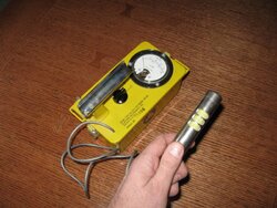
FYI, I just read that the Ronald Reagan sailed through a radioactive cloud of about 30x normal background radiation. It's out there and being tracked, and hopefully dissipating quite a lot before reaching the west coast.

Having sailed the North Pacific for 7 or 8 years before crossing the equator I have always been fascinated by its complex wind patterns (which I could only ignore, of course, at my own peril). I consider the US Navy's FNMOC (Fleet Numerical Meteorology and Oceanography Center) website the Granddaddy of all marine weather modeling sites. My preference usually goes to the Nogaps and/or Coamp models. Most (all?) of the commercial sites, appear to use one or more of the handful of FNMOC models while dressing them up in fancier graphics. Please do not be cowed by your browser's warning that the site's signature cannot be trusted (this is the US government).

Although everyone seems to be focusing on the North Pacific jet stream (which always blows towards the East at great speed and could indeed deliver radioactive emissions to the West Coast in one to two weeks) [edit: please read 4-5 days] only a major explosion should be able to propel radioactive emissions (most of which are heavier than air) into the stratosphere at heights of 30,000 feet or more were they can be swept up by the jet stream.

Lower altitude wind transport across the Pacific consists of the steady NE Tradewinds, typically dominant below 20 degs North, which pass well South of Japan but can pick up Japanese air pollutants carried South; e.g. by the clockwise circulation around the succession of North Pacific Highs off the coast of Japan. If so, this would mostly result in the pollutants being carried in SW direction towards the Asian continent.

Alternatively, considering the location of the faulty reactors in the North of Japan, the products could be carried East by the endless procession of highs and lows (otherwise known as the Variables) filling the Northern Pacific and resulting in more or less dominant Westerlies. Such a circuitous route would take much longer and probably result in a great amount of dilution before reaching the US West Coast, if at all.

A wellknown example of major fine particle transport across the ocean to the USA happens regularly on the East Coast, where fine dust from the African Sahara is carried West to Florida and neighboring states at relatively low altitudes, even though the high altitude Atlantic jet streams also blow towards the East......

On YouTube there are several animated charts showing how radioactive cesium emissions from the Chernobyl disaster spread over Europe, The Middle East, SE Asia and North Africa in the first weeks after the accident. Since this was a pretty big explosion (no containment vessel at all) , massive amounts of radioactive emission products appeared to travel high enough into the stratosphere to be swept Eastward by the jet stream whereas lower altitude emissions were swept West over Western Europe and Scandinavia, creating the puzzling appearance of two fairly narrow emission jets traveling in opposite directions (viz West and East).

Henk
 
The NY Times has posted a graph showing the radiation levels measured at the Daiichi plant perimeter this week that some may find helpful.
http://www.nytimes.com/interactive/...110316-japan-quake-radiation.html?ref=science

They also have a simulation based on a continuous plume coming from the site. <There is no high altitude, continuous plume at this point, this is just a simulation>. Unfortunately the units are arbitrary which makes this simulation less informative. But it's helpful in to see the effect of distance and time on the radiation levels.
http://www.nytimes.com/interactive/2011/03/16/science/plume-graphic.html?ref=science

And finally there is this piece which is trying to put the current situation in context as far as the effects in the US.
http://www.csmonitor.com/World/Asia...risis-far-exceeds-actual-risks-say-scientists
 
BeGreen said:
They also have a simulation based on a continuous plume coming from the site. <There is no high altitude, continuous plume at this point, this is just a simulation>. Unfortunately the units are arbitrary which makes this simulation less informative. But it's helpful in to see the effect of distance and time on the radiation levels.
http://www.nytimes.com/interactive/2011/03/16/science/plume-graphic.html?ref=science

Thanks for that link. I came across it too but failed to see any clear references to the effects of release altitude. Yet, they are clearly modeling a jet stream transport scenario, rather than the current low-altitude releases. Of course, it would only take one big thunderstorm, let alone a cyclonic event, to lift the radioactive fine particulate matter high enough, let's say above 15,000 feet to start feeding into some of the lower jet stream branches.

Absent such events, or a massive fire (which appears alas to become a bit more likely by the hour, right now), I have a hard time seeing how such heavy stuf can spontaneously make it up there. It is of course also possible that the low-altitude atmospheric particulate matter models are still as unreliable as they were 5 years or so ago, when we used them to try and model some urban PM dispersion/deposition scenarios. If so, they may simply have chosen the high altitude scenario since it is the only one they have decent models for....

Henk
 
Yesterdays reports in which minuscule quantities of fine radioactive particles thought to be derived from the crippled Fukushima reactors have been detected on the US west coast make perfect sense if we assume that these must have been released into the higher altitudes by one of the hydrogen explosions.

These explosions may well have been powerful enough to propel some particles into the upper atmosphere, thus enabling them to reach the US coast along the jet stream, in about the right amount of time (i.e. 3-5 days).

Fortunately, the amount of radiatio-active material emitted during these early explosions (one of which also affected the US navy vessels standing off that coast) appears to have been relatively small. However, if one or more of the spent fuel rod storage pools do fall dry and such explosions were to be repeated, I would not be surprised to see much stronger signatures here in the Western USA.

Henk
 
Status
Not open for further replies.