
Tonight: Partly cloudy, with a low around 9. Wind chill values as low as -4. Blustery, with a north wind between 13 and 22 mph, with gusts as high as 32 mph.
Vroooooom, Vrooooooom
- Thread starter babalu87
- Start date
-
Active since 1995, Hearth.com is THE place on the internet for free information and advice about wood stoves, pellet stoves and other energy saving equipment.
We strive to provide opinions, articles, discussions and history related to Hearth Products and in a more general sense, energy issues.
We promote the EFFICIENT, RESPONSIBLE, CLEAN and SAFE use of all fuels, whether renewable or fossil.
You are using an out of date browser. It may not display this or other websites correctly.
You should upgrade or use an alternative browser.
You should upgrade or use an alternative browser.
- Status
- Not open for further replies.
Highbeam
Minister of Fire
Tonight: Rain showers early becoming a steady light rain overnight. Low 39F. Winds SSE at 5 to 10 mph.
Rain, rain, everywhere.
Rain, rain, everywhere.
DriftWood
Minister of Fire
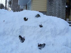
No Vroooooom, Vrooooooom on the river too much snow every place else. They are using the roads though.
swestall
Minister of Fire
Yahoooooo- maybe now we'll really get a draft up and see what the heck this thing can do.
Besides suck wood that is.....
Besides suck wood that is.....
Hogwildz
Minister of Fire
Hogwildz
Minister of Fire
Now they are calling for 55 Tuesday & 57 Wednesday, I'll believe it when I feel it.
Thats a ways off though, alot could change. Now wishing the bike wasn't under wraps.
Thats a ways off though, alot could change. Now wishing the bike wasn't under wraps.
Webwidow
Member
nshif
New Member
Not so nice out here
BLIZZARD WARNING IN EFFECT FROM 4 AM FRIDAY TO 4 AM PST
SATURDAY..
...WINTER STORM WATCH NO LONGER IN EFFECT..
THE NATIONAL WEATHER SERVICE IN SACRAMENTO HAS ISSUED A BLIZZARD
WARNING...WHICH IS IN EFFECT FROM 4 AM FRIDAY TO 4 AM PST
SATURDAY. THE WINTER STORM WATCH IS NO LONGER IN EFFECT.
THE FIRST IN A SERIES OF STORMS IS FORECAST TO IMPACT THE SIERRA
NEVADA LATE THURSDAY THROUGH FRIDAY MORNING. A SECOND MORE POWERFUL
STORM WILL MOVE THROUGH THE SIERRA CASCADE RANGE FRIDAY AFTERNOON
THROUGH SATURDAY MORNING.
SNOWFALL AMOUNTS FROM 3 TO 5 FEET ARE EXPECTED OVER THE SIERRA
NEVADA BETWEEN THURSDAY EVENING AND SATURDAY MORNING ABOVE SNOW
LEVELS WITH SEVERAL MORE FEET OF SNOW POSSIBLE AT THE HIGHEST
ELEVATIONS. SNOWFALL IS LIKELY TO ACCUMULATE AT A RATE OF SEVERAL
INCHES PER HOUR AT TIMES THROUGH THE WARNING PERIOD...THE HEAVIEST
SNOWFALL EXPECTED FRIDAY AFTERNOON WITH THE STRONGER SECOND SYSTEM.
IN ADDITION TO THE HEAVY SNOWFALL...STRONG WINDS ARE EXPECTED.
WIND SPEED GUSTS IN EXCESS OF 65 MPH ARE EXPECTED WITH THE THURSDAY
NIGHT SYSTEM AND WIND SPEED GUSTS IN EXCESS OF 100 MPH POSSIBLE
ON FRIDAY AFTERNOON WITH THE SECOND SYSTEM. THE COMBINATION OF
HEAVY SNOW AND POWERFUL WIND WILL LIKELY CAUSE FREQUENT WHITEOUT
CONDITIONS. TRAVEL OVER THE HIGHER PASSES WILL BE VERY DIFFICULT..
IF NOT IMPOSSIBLE AT TIMES BETWEEN THURSDAY EVENING AND SATURDAY
MORNING.
THE WIND AND SNOW MAY DECREASE BY MID DAY SATURDAY...BUT WILL NOT
ENTIRELY END. A THIRD...COLDER STORM IS EXPECTED TO MOVE OVER THE
AREA LATE SATURDAY INTO SUNDAY WITH A FOOT OR MORE OF ADDITIONAL
SNOW POSSIBLE.
SNOW LEVELS WILL BEGIN AROUND 5500 TO 6000 THURSDAY NIGHT INTO
FRIDAY. LOWER SNOW LEVELS ARE EXPECTED FRIDAY NIGHT INTO
SATURDAY...FROM 3500 TO 4500 FEET. EVEN LOWER SNOW LEVELS ARE
FORECAST FOR SATURDAY NIGHT AND SUNDAY.
A BLIZZARD WARNING MEANS SEVERE WINTER WEATHER CONDITIONS ARE
EXPECTED OR OCCURRING. FALLING AND BLOWING SNOW WITH STRONG WINDS
AND POOR VISIBILITIES ARE LIKELY. THIS WILL LEAD TO WHITEOUT
CONDITIONS...MAKING TRAVEL EXTREMELY DANGEROUS. DO NOT TRAVEL. IF
YOU MUST...HAVE A WINTER SURVIVAL KIT WITH YOU. IF YOU GET
STRANDED...STAY WITH YOUR VEHICLE.
northwinds
Minister of Fire
swestall
Minister of Fire
Corie
Minister of Fire
Below 19 here right now. I will be getting up during the night to reload for sure tonight. Luckily I already have my load cut, nailed together and ready to burn.
GVA
Minister of Fire
Yeah what's up with that I feel like I'm back in Mass this time of year........19* this morning with a good stiff wind about 20mph..........That's f'ing cold......Corie said:Below 19 here right now. I will be getting up during the night to reload for sure tonight. Luckily I already have my load cut, nailed together and ready to burn.
KateC
New Member
rhetoric
Member
nshif said:Not so nice out here
BLIZZARD WARNING IN EFFECT FROM 4 AM FRIDAY TO 4 AM PST
SATURDAY..
...WINTER STORM WATCH NO LONGER IN EFFECT..
THE NATIONAL WEATHER SERVICE IN SACRAMENTO HAS ISSUED A BLIZZARD
WARNING...WHICH IS IN EFFECT FROM 4 AM FRIDAY TO 4 AM PST
SATURDAY. THE WINTER STORM WATCH IS NO LONGER IN EFFECT.
THE FIRST IN A SERIES OF STORMS IS FORECAST TO IMPACT THE SIERRA
NEVADA LATE THURSDAY THROUGH FRIDAY MORNING. A SECOND MORE POWERFUL
STORM WILL MOVE THROUGH THE SIERRA CASCADE RANGE FRIDAY AFTERNOON
THROUGH SATURDAY MORNING.
SNOWFALL AMOUNTS FROM 3 TO 5 FEET ARE EXPECTED OVER THE SIERRA
NEVADA BETWEEN THURSDAY EVENING AND SATURDAY MORNING ABOVE SNOW
LEVELS WITH SEVERAL MORE FEET OF SNOW POSSIBLE AT THE HIGHEST
ELEVATIONS. SNOWFALL IS LIKELY TO ACCUMULATE AT A RATE OF SEVERAL
INCHES PER HOUR AT TIMES THROUGH THE WARNING PERIOD...THE HEAVIEST
SNOWFALL EXPECTED FRIDAY AFTERNOON WITH THE STRONGER SECOND SYSTEM.
IN ADDITION TO THE HEAVY SNOWFALL...STRONG WINDS ARE EXPECTED.
WIND SPEED GUSTS IN EXCESS OF 65 MPH ARE EXPECTED WITH THE THURSDAY
NIGHT SYSTEM AND WIND SPEED GUSTS IN EXCESS OF 100 MPH POSSIBLE
ON FRIDAY AFTERNOON WITH THE SECOND SYSTEM. THE COMBINATION OF
HEAVY SNOW AND POWERFUL WIND WILL LIKELY CAUSE FREQUENT WHITEOUT
CONDITIONS. TRAVEL OVER THE HIGHER PASSES WILL BE VERY DIFFICULT..
IF NOT IMPOSSIBLE AT TIMES BETWEEN THURSDAY EVENING AND SATURDAY
MORNING.
THE WIND AND SNOW MAY DECREASE BY MID DAY SATURDAY...BUT WILL NOT
ENTIRELY END. A THIRD...COLDER STORM IS EXPECTED TO MOVE OVER THE
AREA LATE SATURDAY INTO SUNDAY WITH A FOOT OR MORE OF ADDITIONAL
SNOW POSSIBLE.
SNOW LEVELS WILL BEGIN AROUND 5500 TO 6000 THURSDAY NIGHT INTO
FRIDAY. LOWER SNOW LEVELS ARE EXPECTED FRIDAY NIGHT INTO
SATURDAY...FROM 3500 TO 4500 FEET. EVEN LOWER SNOW LEVELS ARE
FORECAST FOR SATURDAY NIGHT AND SUNDAY.
A BLIZZARD WARNING MEANS SEVERE WINTER WEATHER CONDITIONS ARE
EXPECTED OR OCCURRING. FALLING AND BLOWING SNOW WITH STRONG WINDS
AND POOR VISIBILITIES ARE LIKELY. THIS WILL LEAD TO WHITEOUT
CONDITIONS...MAKING TRAVEL EXTREMELY DANGEROUS. DO NOT TRAVEL. IF
YOU MUST...HAVE A WINTER SURVIVAL KIT WITH YOU. IF YOU GET
STRANDED...STAY WITH YOUR VEHICLE.
So I know most places out west have been experiencing drought, especially in terms of snowpack for summer melting (resevoirs and such). According the the maps it looks like you're all getting hammered. Any of this going to effect the moisture issues?
Hogwildz
Minister of Fire
GVA said:Yeah what's up with that I feel like I'm back in Mass this time of year........19* this morning with a good stiff wind about 20mph..........That's f'ing cold......Corie said:Below 19 here right now. I will be getting up during the night to reload for sure tonight. Luckily I already have my load cut, nailed together and ready to burn.
Bet you wish ya took that Harman with ya now don't ya?
")
78 @ living room
71 in den
68 upstairs at 10:00 PM
Full load burning secondary and 12 degrees. Winds 15-25 out of the NNW
73 @ living room
67 in den
68 upstairs at 5:00 AM
Big coal bed, re-load the stove and head to work
6 degrees and North winds around 10-15
71 in den
68 upstairs at 10:00 PM
Full load burning secondary and 12 degrees. Winds 15-25 out of the NNW
73 @ living room
67 in den
68 upstairs at 5:00 AM
Big coal bed, re-load the stove and head to work
6 degrees and North winds around 10-15
FiremanBob
New Member
9.5 outside, 66 here in the office with the stove pumping out heat, 60 in the adjoining kitchen. Dog is blissfully napping next to the stove. Great to think I can get out on the motorcycle this weekend.
swestall
Minister of Fire
Zero at the lowest; stove kept the house warm; even with overnight float down it stayed above 66. Now about that motorcycle ride; if this "Ain't" a good case for the old, "if you don't like the weather in New England just wait a minute it will change", then I don't know what is.
This Zero stuff is just a test you know, wait till the Jan thaw is over and we get into Feb !!
!!
This Zero stuff is just a test you know, wait till the Jan thaw is over and we get into Feb
!!Gunner
New Member
I love these posts where we all give are current weather...
-18C last night, full load in the stove at 9pm, 76deg in the house, off to bed.
5am up for work house is 72deg stove is 450.
It's nice having more stove than you need, "gaining ground" easily in minus double digits rules!
-18C last night, full load in the stove at 9pm, 76deg in the house, off to bed.
5am up for work house is 72deg stove is 450.
It's nice having more stove than you need, "gaining ground" easily in minus double digits rules!
I'm glad to hear you're all nice and warm. The temperature here right now (10:30pm) is 8C/46F. Coldest temp ever recorded since records began is -4C/24F.
- Status
- Not open for further replies.
Similar threads
- Replies
- 6
- Views
- 507
- Replies
- 6
- Views
- 821
- Replies
- 22
- Views
- 930