It's been a good month since the saws had any rotation going and I'm ready for some cutting that will last straight through the summer.
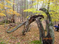
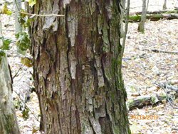
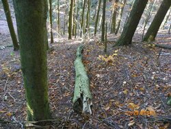
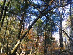
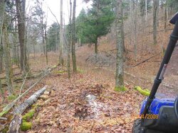
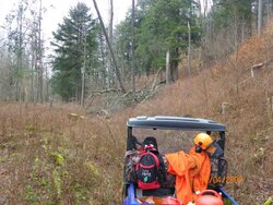
Looking for another three or four cord by next winter. I'm guessing that I cut three cord until I was snowbound this winter. Attached are some of the stuff down or topped off from up top, most of the wood should come from lower part of the woodlands this year.
--------------------------------------------------------------------------------
Issued by The National Weather Service
Burlington, VT
Sat, Mar 5, 2011, 12:00 AM EST
... WINTER STORM WARNING IN EFFECT FROM 1 AM SUNDAY TO 7 AM EST MONDAY...
THE NATIONAL WEATHER SERVICE IN BURLINGTON HAS ISSUED A WINTER STORM WARNING... WHICH IS IN EFFECT FROM 1 AM SUNDAY TO 7 AM EST MONDAY. THE WINTER STORM WATCH IS NO LONGER IN EFFECT.
* LOCATIONS... NORTHERN ADIRONDACK MOUNTAINS AND SAINT LAWRENCE VALLEY.
* HAZARD TYPES... HEAVY SNOW.
* ACCUMULATIONS... SNOW ACCUMULATION OF 8 TO 16 INCHES... ALONG WITH A TRACE OF ICE ACCUMULATION POSSIBLE.
* TIMING... RAIN CHANGES TO SNOW EARLY SUNDAY MORNING... AND BECOMES HEAVY AT TIMES SUNDAY AFTERNOON INTO SUNDAY NIGHT.
* IMPACTS... THE HEAVY WET SNOW WILL CAUSE SCATTERED POWER OUTAGES... ALONG WITH HAZARDOUS DRIVING CONDITIONS.
* WINDS... NORTH 10 TO 15 MPH WITH GUSTS UP TO 30 MPH ON SUNDAY.
* TEMPERATURES... FALLING INTO THE 20S ON SUNDAY.
* VISIBILITIES... BELOW ONE HALF OF A MILE AT TIMES.
PRECAUTIONARY/PREPAREDNESS ACTIONS...
A WINTER STORM WARNING FOR HEAVY SNOW MEANS SEVERE WINTER WEATHER CONDITIONS ARE EXPECTED. SIGNIFICANT AMOUNTS OF SNOW ARE FORECAST THAT WILL MAKE TRAVEL DANGEROUS. ONLY TRAVEL IN AN EMERGENCY. IF YOU MUST TRAVEL... KEEP AN EXTRA FLASHLIGHT... FOOD... AND WATER IN YOUR VEHICLE IN CASE OF AN EMERGENCY.
Local Temperature Map
Updated Mar 5, 2011, 3:25pm EST
Tips for Snow & Ice Removal
Driving in Snow & Ice
Wintry Precipitation Explained
Get Live Traffic Reports
Zap