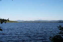
Last week I was camping...

  • Active since 1995, Hearth.com is THE place on the internet for free information and advice about wood stoves, pellet stoves and other energy saving equipment.

    We strive to provide opinions, articles, discussions and history related to Hearth Products and in a more general sense, energy issues.

    We promote the EFFICIENT, RESPONSIBLE, CLEAN and SAFE use of all fuels, whether renewable or fossil.
Status
Not open for further replies.

Delta-T

Minister of Fire
Feb 27, 2008
3,142
NH
and this was the view facing pretty much due south. the mountain under the cloud should be Mt. Washington, and the one one the left should be Mahoosuc.
 

Attachments

  • 100_2039.jpg
    100_2039.jpg
    69.1 KB · Views: 564
Delta-T said:
the mountain under the cloud should be Mt. Washington, and the one one the left should be Mahoosuc.

OK - but what WERE they?
 
Looks to be a shot from the Lake Umbagog National Wildlife refuge? If not, its one of the ponds in the general area. Its a great time of year to be up there until about October 1st, then its gets cold real quick! The fall leaf season starts early but usually is very spectacular. The majority of the lake is undeveloped but the state of NH has a state park and manages remote campsites all around the lake.
 
Delta-T said:
and this was the view facing pretty much due south. the mountain under the cloud should be Mt. Washington, and the one one the left should be Mahoosuc.

Great picture, it looks like you had a good time.

zap
 
peakbagger is right on, lake umbagog. I go a couple times every year to the lake and camp at different spots. did not see any eagles this year, but saw many loons. I have a pic of momma and baby loon that i'll try to remember to post up. I did have a good time, hard not to around there. the lakes pretty shallow so there's very little boat traffic and on an average day i see 2-3 times as many canoes and kayaks as i do power boats, and ones you do see are the small fishing boats and some of those pontoon things.

Jags_ I said should be...because my orienteering skills are not the best, so I cannot be 100% positive of the peaks. my maps of course could be liars as well, so I'm stickin with "should" be....
 
I do get a chuckle when the federal government declares a national wildlife refuge on a man made lake. I have seen maps of the lake that show the stone walls that run underneath the water in spots. Lake Umbagog used to be the home of a floating island but I havent heard much about it of late. The paddle down the magaloway from the north bridge in Wilson Mills is a fun one earlier in the summer. It has some good spots of fast current until it hits the deadwater from the lake.
 
I love the ride down from Wilson's Mills, I brought my 7 year old this year, so we put in at the Refuge HQ on rt 16 and paddled the distance to the lake and about half way down to the site, paddled down the Andro to the dam in errol after 3 days on the lake. I think the only part tha would be a lake without the dam is the north section where the rapid empties in. I think the deepest part of the lake is there (I've heard as deep as 187' but the locals tell me about 80') and the rock walls on the lake bottom are very apparent in spots, especially where you hear the run-abouts smash their props into them. I've not heard of this floating island, that sounds interesting. there is Matalik Island, you can see it in the pic, with the lil single wide trailer on it, and a nice gazebo. I assume they truck the propane out in the winter.
Several other small islands aboutt 15' across and one big island, called Big Island (go figure,1/4 mile across maybe) with 2 residences and 5-6 campsites on it. ONly 30 or so sites on the whole lake which is nice.
 
Status
Not open for further replies.